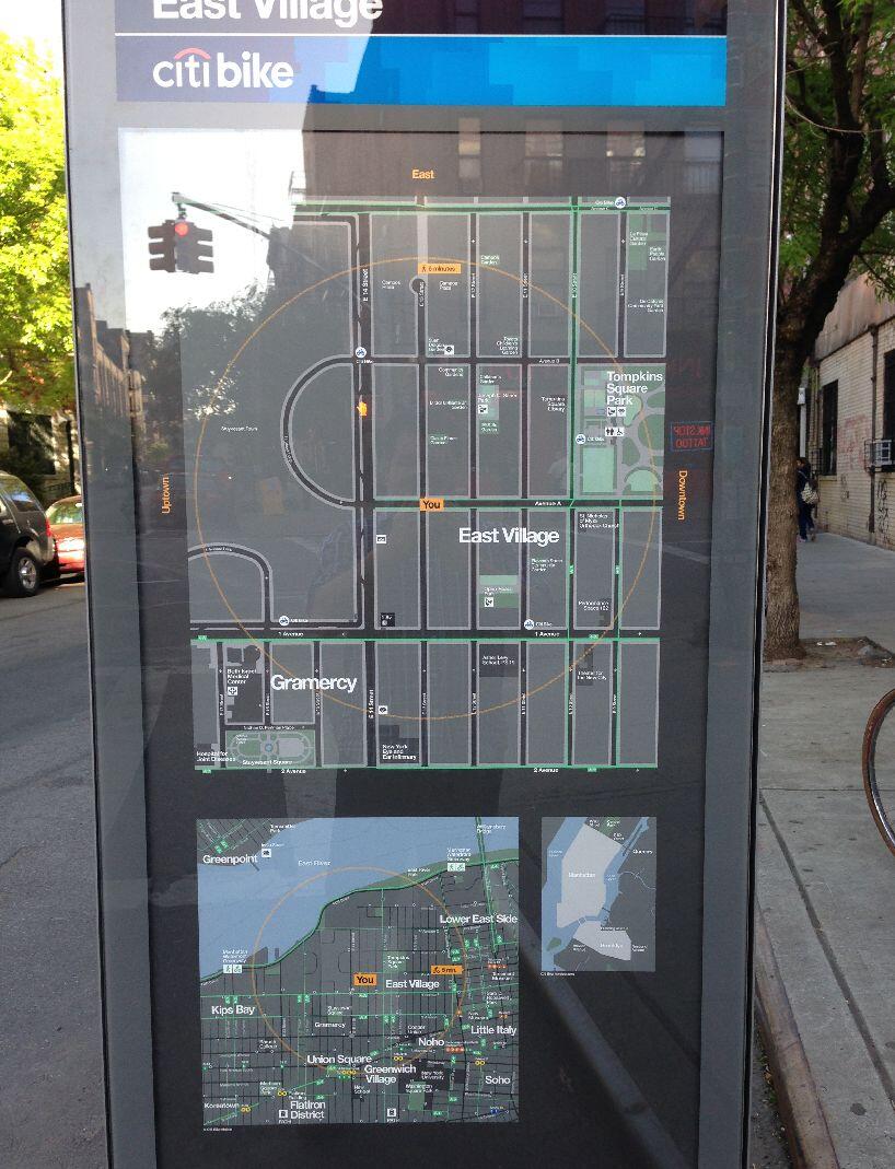
Citibike welcomes you to the North Village
Hey Citibike,
You managed to do something no one has ever done before: make Manhattan confusing. The city is famously a simple numbered grid. It's also close to north/south aligned so it's easy to think of the streets all corresponding to the four cardinal directions. It's so straightforward that this is where we get the terms "downtown" and "uptown" from, which are now used all over the world, even in cities where "downtown" is in the north. The simplicity of the grid is a big part of New York's success over the past 400 years.
So why do you think you know better? I'm referring to your new Citibike program all over the city, which lets people rents bikes and return them elsewhere. A great idea and plan, which syncs well with all the new bike paths in recent years. The only catch? At each drop-off point - and there are dozens - you show a helpful map. See any problem? (You can click to zoom in.)

That's right, East is up. In fact, at any given drop-off point, any direction might be up, based on the direction the signpost is facing. This is not how maps work. What's sad is, I can picture your thought process: "Hey, let's make it easier for people to understand by making the map face the right way." A great idea, except no one has ever done it before, so no one expects it. We have a convention of north at top, and because it's a convention, it's the easiest thing to understand. And nowhere is this more poignant that in the normally directionally-simple Manhattan. I've lived here for 10 years, and when I first saw this map, I had to study it to figure out what was going on. It's incredibly confusing. The sign says "East Village" but it might as well be the North Village.
I especially like how in the third map on the sign, the small zoomed-out version, it's rotated correctly, as if you realized your mistake at the last minute. Not only is it bad that in the process of looking from one map to another on the same sign, you have to rotate, but in that zoomed-out map, you don't even show a rectangle indicating the location of the other maps.
It's 2013. We've had maps figured out for hundreds of years. You don't have to reinvent them. Go back to design school, Citibike.
Sincerely,
Jesse